Views

How to ensure improved resilience to tropical cyclones
Proper preparations and mitigating actions can improve resilience to tropical cyclones 
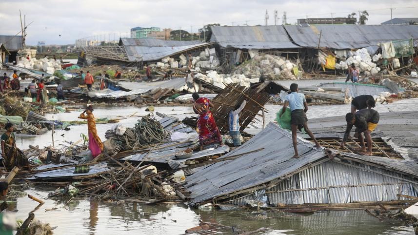
At least 10,000 homes were ruined, 6000 hectares of cropland were ruined, and 1000 fish enclosures were washed away during cyclone Sitrang. Photo: Star

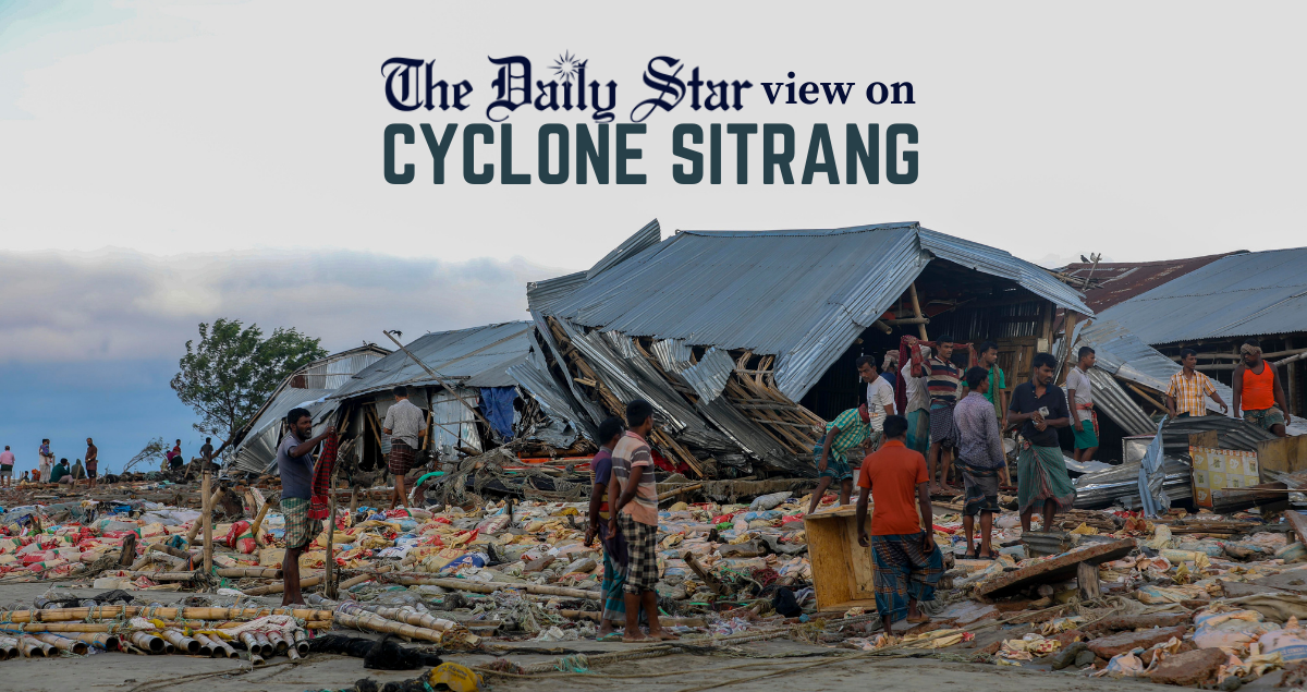
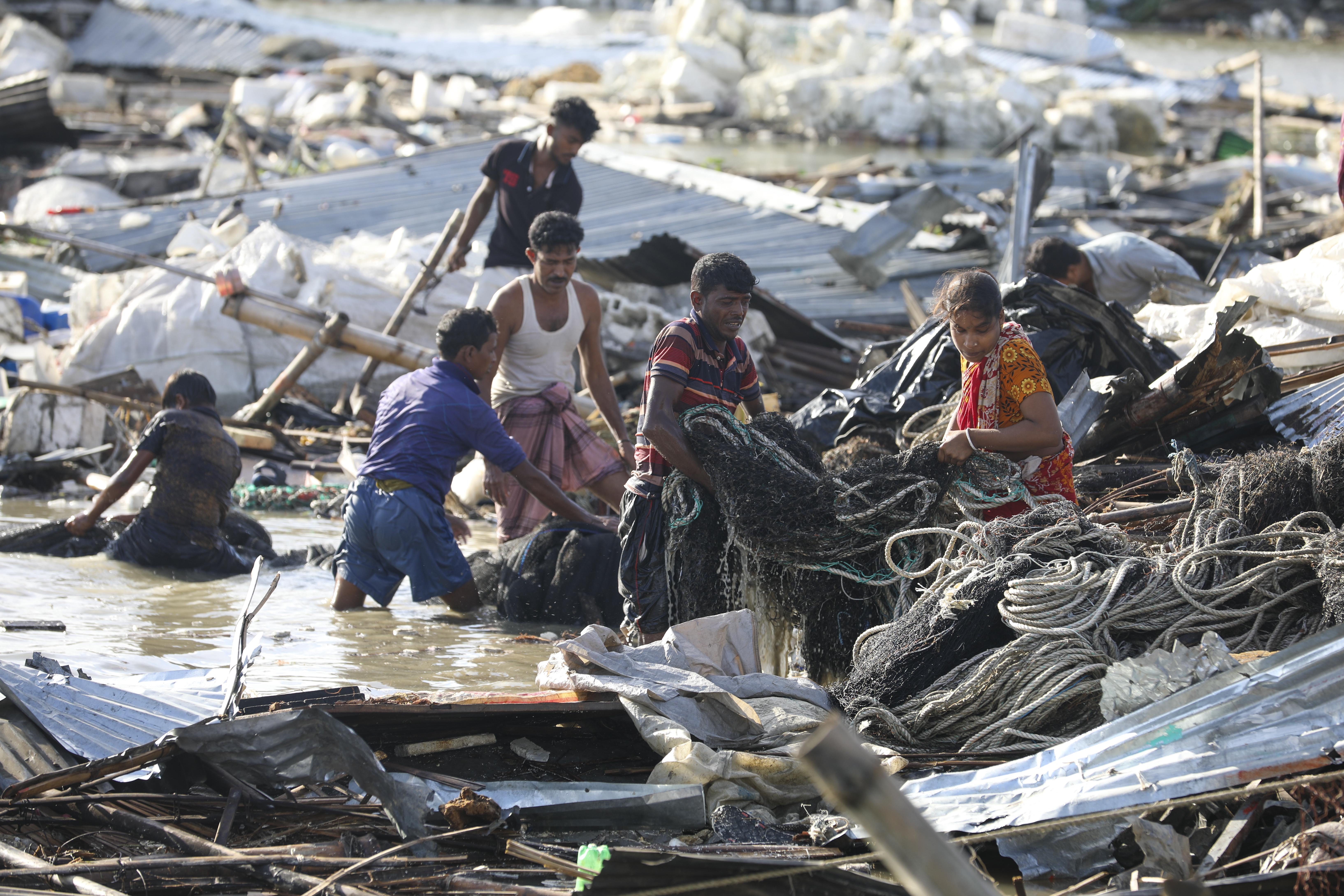
Over the last few decades, the tropical cyclone intensity has increased as the ocean climate has warmed. Globally, the frequency of short-term tropical cyclones has seen a significant increase. Tropical cyclones in Bangladesh cause great damage to the socio-economy of the affected regions. The recent cyclone Sitrang created a strong wind gust and caused heavy rainfall in the coastal regions. Some districts saw tides as high surges. The affected regions saw the fall of large trees, trunks, poles, and other large objects, causing blockage on the roads, destroying houses, and killing several people. Reports show that 10,000 homes were ruined, 6000 hectares of cropland were ruined, and 1000 fish enclosures were washed away. 

Bangladesh's coastal regions are poor and underdeveloped, making them vulnerable to cyclones and other natural calamities. Every year, cyclones destroy the basic services including education and ICT communication of local communities. People of these regions become unable to sustain their families in the aftermath of the cyclone. A growing number of climate-induced migrants (CIMs) are moving from rural areas to nearby towns, growth centres, and large cities every year to take shelter and earn a secure livelihood. But finally, most of them end up in city slums and fringe areas and live in inhumane conditions without basic amenities, decent employment, and social security. 

To reduce the coastal risk and vulnerability to the cyclone, local governments, affected communities, as well as national and international NGOs and institutions must take action. In addition, resilient infrastructure needs to be built to protect the livelihoods of the people in the coastal communities. Cyclone shelters need to be available at the union and village levels in the coastal region. 

Shelters are crucial to protect the local people in the event of a cyclone which brings massive floods and destruction of their homes and their land. The model cyclone shelters need to assure gender sensitivity. There should be separate hygiene facilities for men and women, and adequate food and water supply. For each sub-district and union, site selection of the shelters are very important. They need to be built at a higher topography with lower vulnerability to disasters. 

There should also be an adequate number of shelters to host every individual in a community in the event of a disaster. Based on the latest population census, such measurements and design of model cyclone shelters are necessary to protect the local communities. Medical facilities and other social services need to be made available in the model cyclone shelters, with enough aid available to the communities in the case of a disaster. 

Coastal embankments are crucial infrastructure to reduce cyclone risk management. In contrast, the embankments can hold the water from flowing into the land and destroying homes. Local communities have complained that the current embankments are not high or strong enough to hold the tides from passing, and often are damaged by high tidal waves. Integrated research needs to be conducted to determine the efficient height and firmness of the embankment. Strom height and previous cyclone data should be consulted and studied to determine the most efficient architecture for embankments in the coastal region of Bangladesh. The embankments can also have sluice gates installed, if the water does get through, it can flow back out and not be forced into the land area. Embankments can help move the local communities to safety and take appropriate adaptation action and safety precautions, and lower the effects of a tropical cyclone on the coastal communities. 

Coastal afforestation is an integral approach towards both adaptation and mitigation against climate change-induced cyclonic disasters. Apart from the Sundarbans, the rest of the coastal belt has little to no forestation. A green belt development along the coast would not only safeguard the communities from the fatalities brought by cyclones but also provide socio-environmental protection and sustainability in the coastal region. Evidence shows that the afforestation would slow down the intensity of the cyclones, and subsequently the damage to the population and livelihood of the coastal region. 

The use of ICT and model-based prediction should be disseminated among the local community to give them potential disaster warnings in advance. This way the communities can take appropriate measures for the coming disaster. They can stock up on food, protect their crops and livestock, and make preparations to go to nearby shelters. Available data for tropical cyclones and their relation to biophysical drivers including temperatures, precipitations, and wind can be extracted from the recent past, and various models can be prepared for the coastal regions where the cyclones originate. Real-time satellite data-based early warnings, and directions for instructions can allow for a smoother transition to a cyclone shelter, or preparedness for a climate-induced disasters.

Md. Nasir Uddin is a Research Fellow of the Bangladesh Centre for Advanced Studies (BCAS) and country network manager of Cap-Net Bangladesh. He can be reached at ahamedn00@gmail.com


Comments

How to ensure improved resilience to tropical cyclones

Proper preparations and mitigating actions can improve resilience to tropical cyclones 
At least 10,000 homes were ruined, 6000 hectares of cropland were ruined, and 1000 fish enclosures were washed away during cyclone Sitrang. Photo: Star

Over the last few decades, the tropical cyclone intensity has increased as the ocean climate has warmed. Globally, the frequency of short-term tropical cyclones has seen a significant increase. Tropical cyclones in Bangladesh cause great damage to the socio-economy of the affected regions. The recent cyclone Sitrang created a strong wind gust and caused heavy rainfall in the coastal regions. Some districts saw tides as high surges. The affected regions saw the fall of large trees, trunks, poles, and other large objects, causing blockage on the roads, destroying houses, and killing several people. Reports show that 10,000 homes were ruined, 6000 hectares of cropland were ruined, and 1000 fish enclosures were washed away. 

Bangladesh's coastal regions are poor and underdeveloped, making them vulnerable to cyclones and other natural calamities. Every year, cyclones destroy the basic services including education and ICT communication of local communities. People of these regions become unable to sustain their families in the aftermath of the cyclone. A growing number of climate-induced migrants (CIMs) are moving from rural areas to nearby towns, growth centres, and large cities every year to take shelter and earn a secure livelihood. But finally, most of them end up in city slums and fringe areas and live in inhumane conditions without basic amenities, decent employment, and social security. 

To reduce the coastal risk and vulnerability to the cyclone, local governments, affected communities, as well as national and international NGOs and institutions must take action. In addition, resilient infrastructure needs to be built to protect the livelihoods of the people in the coastal communities. Cyclone shelters need to be available at the union and village levels in the coastal region. 

Shelters are crucial to protect the local people in the event of a cyclone which brings massive floods and destruction of their homes and their land. The model cyclone shelters need to assure gender sensitivity. There should be separate hygiene facilities for men and women, and adequate food and water supply. For each sub-district and union, site selection of the shelters are very important. They need to be built at a higher topography with lower vulnerability to disasters. 

There should also be an adequate number of shelters to host every individual in a community in the event of a disaster. Based on the latest population census, such measurements and design of model cyclone shelters are necessary to protect the local communities. Medical facilities and other social services need to be made available in the model cyclone shelters, with enough aid available to the communities in the case of a disaster. 

Coastal embankments are crucial infrastructure to reduce cyclone risk management. In contrast, the embankments can hold the water from flowing into the land and destroying homes. Local communities have complained that the current embankments are not high or strong enough to hold the tides from passing, and often are damaged by high tidal waves. Integrated research needs to be conducted to determine the efficient height and firmness of the embankment. Strom height and previous cyclone data should be consulted and studied to determine the most efficient architecture for embankments in the coastal region of Bangladesh. The embankments can also have sluice gates installed, if the water does get through, it can flow back out and not be forced into the land area. Embankments can help move the local communities to safety and take appropriate adaptation action and safety precautions, and lower the effects of a tropical cyclone on the coastal communities. 

Coastal afforestation is an integral approach towards both adaptation and mitigation against climate change-induced cyclonic disasters. Apart from the Sundarbans, the rest of the coastal belt has little to no forestation. A green belt development along the coast would not only safeguard the communities from the fatalities brought by cyclones but also provide socio-environmental protection and sustainability in the coastal region. Evidence shows that the afforestation would slow down the intensity of the cyclones, and subsequently the damage to the population and livelihood of the coastal region. 

The use of ICT and model-based prediction should be disseminated among the local community to give them potential disaster warnings in advance. This way the communities can take appropriate measures for the coming disaster. They can stock up on food, protect their crops and livestock, and make preparations to go to nearby shelters. Available data for tropical cyclones and their relation to biophysical drivers including temperatures, precipitations, and wind can be extracted from the recent past, and various models can be prepared for the coastal regions where the cyclones originate. Real-time satellite data-based early warnings, and directions for instructions can allow for a smoother transition to a cyclone shelter, or preparedness for a climate-induced disasters.

Md. Nasir Uddin is a Research Fellow of the Bangladesh Centre for Advanced Studies (BCAS) and country network manager of Cap-Net Bangladesh. He can be reached at ahamedn00@gmail.com


Comments